"Arctic Express" Coming To The Northwest This Weekend
Via Cliff Mass Weather and Climate blog,
If you live in western Washington, you might want to check that your heating system still works.
If you live in eastern Washington on the slopes of the Cascades, you might want to make sure you have a snow shovel.
If you live in western Montana, you might want to get your chains ready and stock up on food.
An unusually early and intense Arctic express will hit the region this weekend. And our days of Blob warmth will be over for a while.
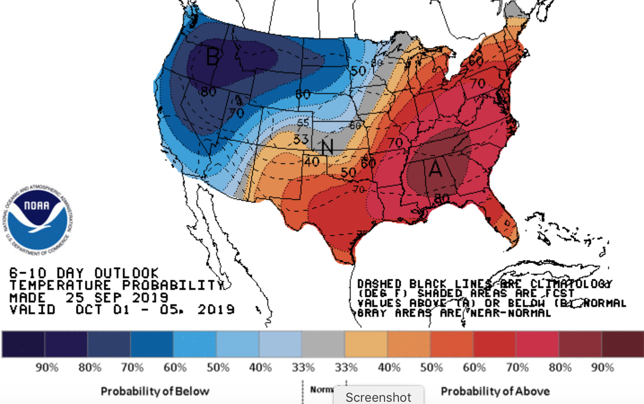
Let me start by showing you a stunning image from the NOAA/NWS Climate Prediction Center (CPC)--their 6-10 day forecast for temperature. Specifically, it gives the probabilities of below normal (blue) and above normal (red) temperatures.
Wow--- my colleagues in NOAA are quite sure that below-normal temperature will reign along the entire West Coast as well as the northern Plains States.
The action starts late Friday.
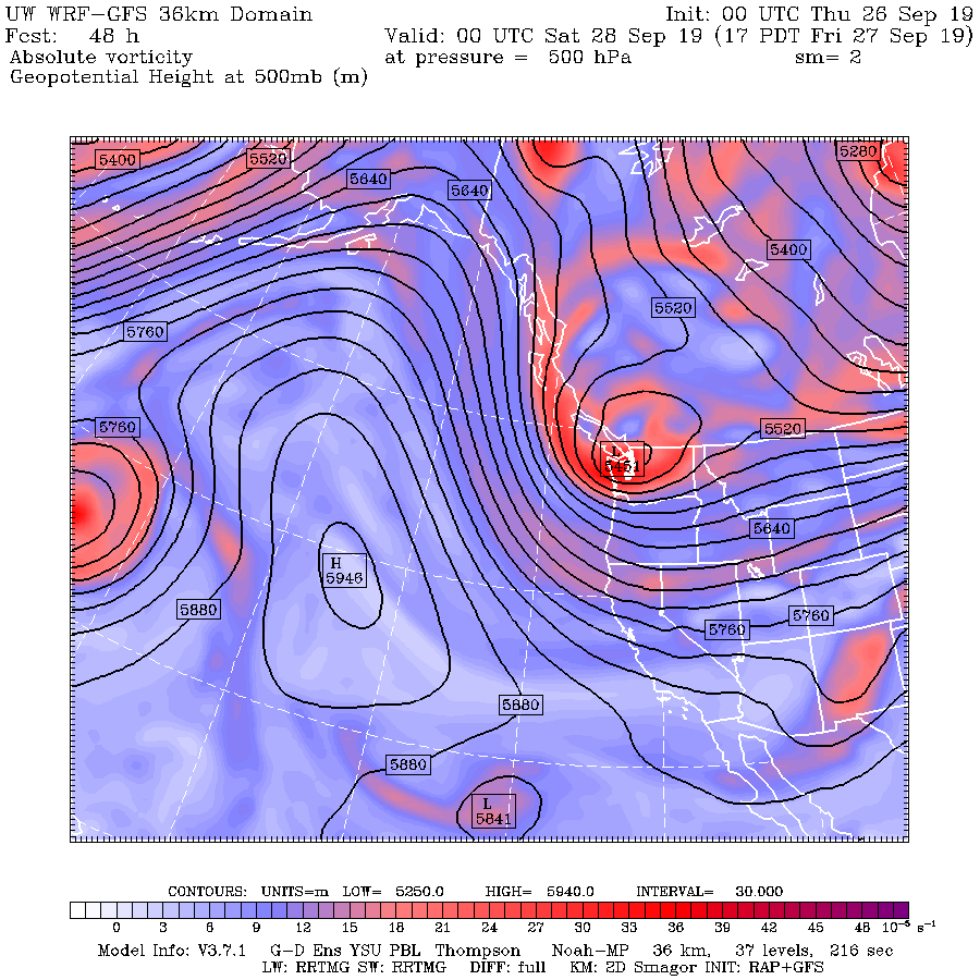
A huge upper level ridge develops in the Pacific, resulting in northerly flow over the western U.S., with a strong trough of low pressure/heights moving into the Pacific Northwest (see upper level-- 500 hPa map for 5 PM Friday below). This pattern will not only bring Arctic air south over the Northwest but will isolate the Northwest from the warming impacts of the Blob (the region of warm water over the northeast Pacific). As a result, western Washington will experience much colder minimum temperatures than observed during the past few months.
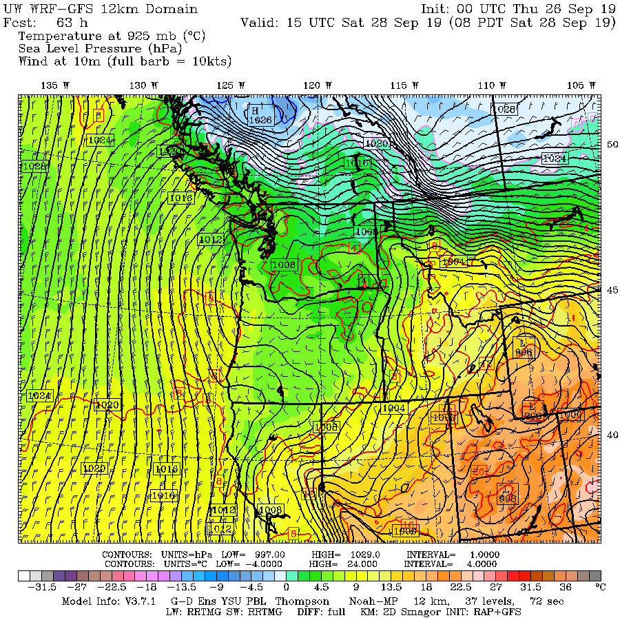
Now the details. Here is a forecast map for 8 AM Saturday, showing sea level pressure (solid lines), lower atmosphere temperatures (color shading) and surface winds. There is an intense pressure change (gradient) near the international border, with cold temperatures behind---this is commonly called the Arctic Front. Low pressure, associated with the upper level trough, is centered over SE Washington.
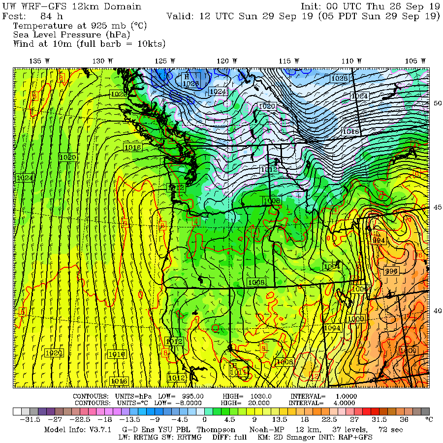
By 5 AM Sunday morning, the cold air and large pressure gradient has pushed south. Eastern Washington, particularly to the east of the Cascade crest, get a piece of it. Montana gets half the pie...with a huge pressure gradient--which means very strong winds will accompany the cold air.
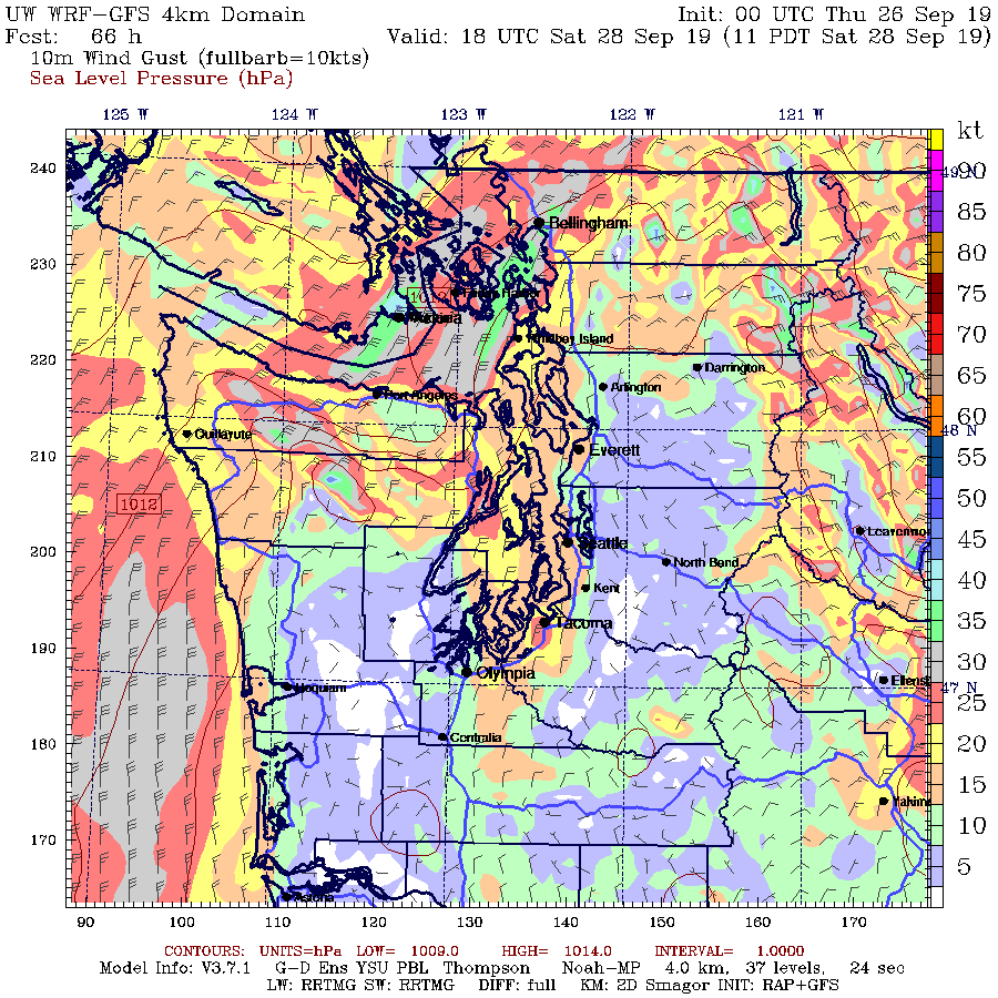
Western Washington will escape the precipitation because the low is too far inland and we will be in the easterly (dry) descending flow. But Bellingham and NW Washington will get very windy, as shown by the forecast for 10 AM Saturday. Wind gusts could get to 35 knots (about 40 mph) from Blaine-Bellingham to over the San Juans. Even in Seattle, winds could breezy and from the north.
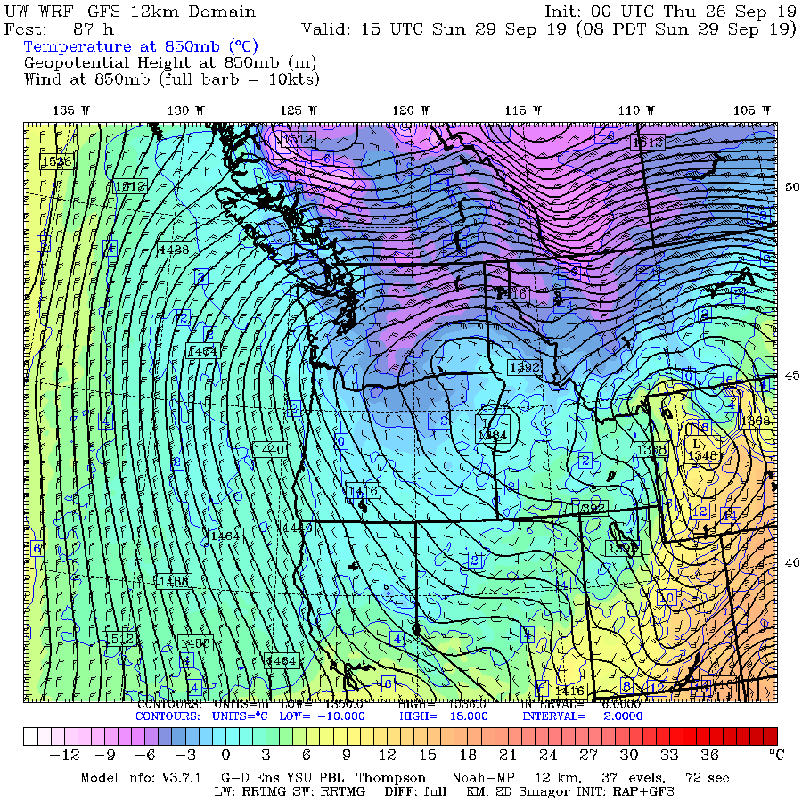
Snow? You bet. The temperatures aloft will be cold for this time of the year. Here is the forecast for 850 hPa (about 5000 ft), with the colors showing temperature and the sold lines showing heights (like pressure). Frigid (below -6C) air over northern eastern Washington, Idaho, and Montana, associated with strong easterly flow.
This means snow.
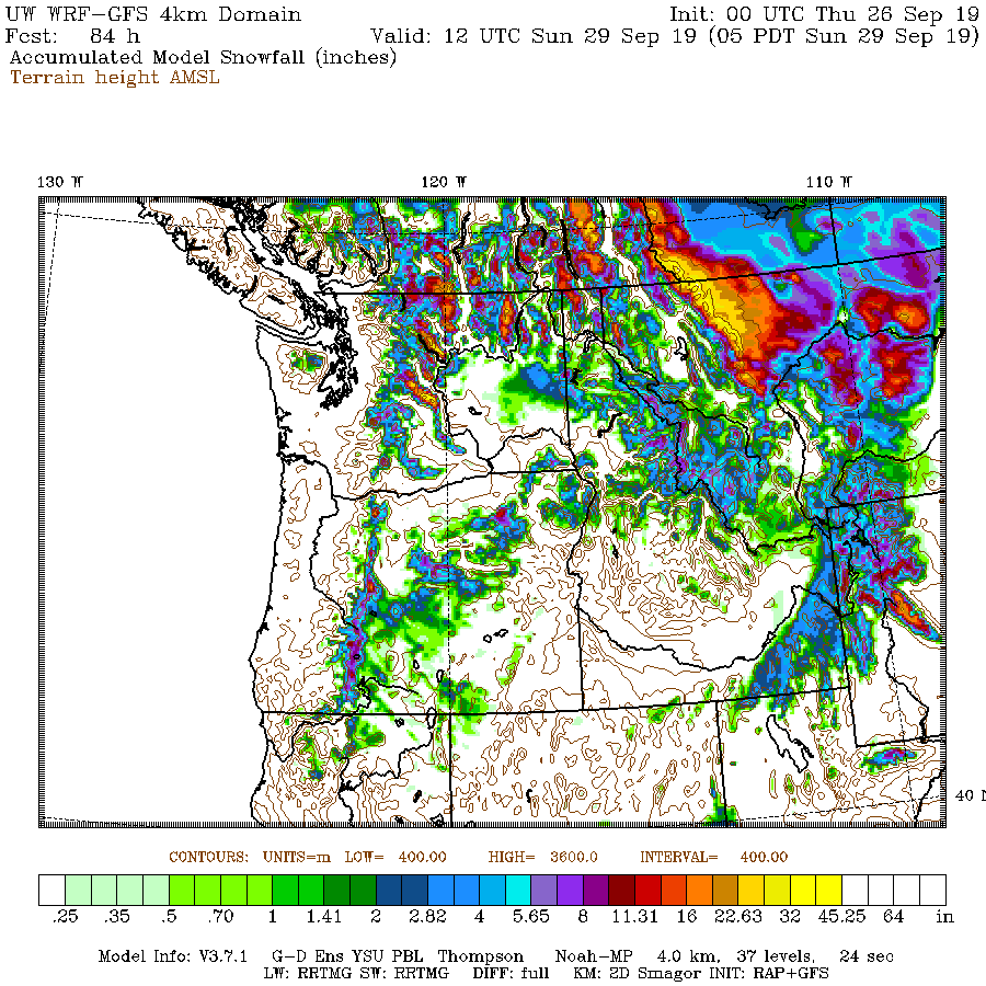
Snow accumulation through 5 AM Sunday (below) show several inches of snow on the eastern slopes of the Cascades, and immense amounts (feet) upstream of the Rockies. Spokane will probably see snow flakes. I suspect there will be some daily temperature and daily snowfall records broken in some locations during the next few days.
https://ift.tt/2lzsgOY
from ZeroHedge News https://ift.tt/2lzsgOY
via IFTTT




0 comments
Post a Comment